The purpose of this lesson is to introduce students to the basic …
The purpose of this lesson is to introduce students to the basic elements of our Earth's crust: rocks, soils and minerals. They learn how we categorize rocks, soils and minerals and how they are literally the foundation for our civilization. Students also explore how engineers use rocks, soils and minerals to create the buildings, roads, vehicles, electronics, chemicals, and other objects we use to enhance our lives.
Students learn about the structure of the earth and how an earthquake …
Students learn about the structure of the earth and how an earthquake happens. In one activity, students make a model of the earth including all of its layers. In a teacher-led demonstration, students learn about continental drift. In another activity, students create models demonstrating the different types of faults.
This video segment adapted from NOVA tells the tragic story of two …
This video segment adapted from NOVA tells the tragic story of two Japanese seismologists who disagreed about the threat of earthquakes in the early twentieth century. Today, seismologists in California offer residents a probability of risk that an earthquake might occur.
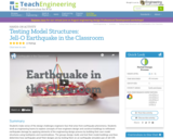
Students learn how engineers construct buildings to withstand damage from earthquakes by …
Students learn how engineers construct buildings to withstand damage from earthquakes by building their own structures with toothpicks and marshmallows. Students test how earthquake-proof their buildings are by testing them on an earthquake simulated in a pan of Jell-O(TM).
Students learn about factors that engineers take into consideration when designing buildings …
Students learn about factors that engineers take into consideration when designing buildings for earthquake-prone regions. Using online resources and simulations available through the Earthquakes Living Lab, students explore the consequences of subsurface ground type and building height on seismic destruction. Working in pairs, students think like engineers to apply what they have learned to sketches of their own building designs intended to withstand strong-magnitude earthquakes. A worksheet serves as a student guide for the activity.
Students learn what causes earthquakes, how we measure and locate them, and …
Students learn what causes earthquakes, how we measure and locate them, and their effects and consequences. Through the online Earthquakes Living Lab, student pairs explore various types of seismic waves and the differences between shear waves and compressional waves. They conduct research using the portion of the living lab that focuses primarily on the instruments, methods and data used to measure and locate earthquakes. Using real-time U.S. Geological Survey (USGS) data accessed through the living lab interface, students locate where earthquakes are occurring and how frequently. Students propose questions and analyze the real-world seismic data to find answers and form conclusions. They are asked to think critically about why earthquakes occur and how knowledge about earthquakes can be helpful to engineers. A worksheet serves as a student guide for the activity.
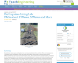
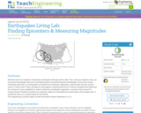
Students learn how engineers characterize earthquakes through seismic data. Then, acting as …
Students learn how engineers characterize earthquakes through seismic data. Then, acting as engineers, they use real-world seismograph data and a tutorial/simulation accessed through the Earthquakes Living Lab to locate earthquake epicenters via triangulation and determine earthquake magnitudes. Student pairs examine seismic waves, S waves and P waves recorded on seismograms, measuring the key S-P interval. Students then determine the maximum S wave amplitudes in order to determine earthquake magnitude, a measure of the amount of energy released. Students consider how engineers might use and implement seismic data in their design work. A worksheet serves as a student guide for the activity.
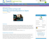
Students study how geology relates to the frequency of large-magnitude earthquakes in …
Students study how geology relates to the frequency of large-magnitude earthquakes in Japan. Using the online resources provided through the Earthquakes Living Lab, students investigate reasons why large earthquakes occur in this region, drawing conclusions from tectonic plate structures and the locations of fault lines. Working in pairs, students explore the 1995 Kobe earthquake, why it happened and the destruction it caused. Students also think like engineers to predict where other earthquakes are likely to occur and what precautions might be taken. A worksheet serves as a student guide for the activity.
Students examine the effects of geology on earthquake magnitudes and how engineers …
Students examine the effects of geology on earthquake magnitudes and how engineers anticipate and prepare for these effects. Using information provided through the Earthquakes Living Lab interface, students investigate how geology, specifically soil type, can amplify the magnitude of earthquakes and their consequences. Students look in-depth at the historical 1906 San Francisco earthquake and its destruction thorough photographs and data. They compare the 1906 California earthquake to another historical earthquake in Kobe, Japan, looking at the geological differences and impacts in the two regions, and learning how engineers, geologists and seismologists work to predict earthquakes and minimize calamity. A worksheet serves as a student guide for the activity.
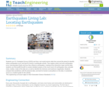
Students use U.S. Geological Survey (USGS) real-time, real-world seismic data from around …
Students use U.S. Geological Survey (USGS) real-time, real-world seismic data from around the planet to identify where earthquakes occur and look for trends in earthquake activity. They explore where and why earthquakes occur, learning about faults and how they influence earthquakes. Looking at the interactive maps and the data, students use Microsoft® Excel® to conduct detailed analysis of the most-recent 25 earthquakes; they calculate mean, median, mode of the data set, as well as identify the minimum and maximum magnitudes. Students compare their predictions with the physical data, and look for trends to and patterns in the data. A worksheet serves as a student guide for the activity.
Students gather evidence to explain the theory of plate tectonics. Using the …
Students gather evidence to explain the theory of plate tectonics. Using the online resources at the Earthquakes Living Lab, students examine information and gather evidence supporting the theory. They also look at how volcanoes and earthquakes are explained by tectonic plate movement, and how engineers use this information. Working in pairs, students think like engineers and connect what they understand about the theory of plate tectonics to the design of structures for earthquake-resistance. A worksheet serves as a student guide for the activity.
In this video segment adapted from NOVA, animations are used to show …
In this video segment adapted from NOVA, animations are used to show how the hills around Los Angeles were formed by earthquakes at small thrust faults that extend outward from the larger San Andreas fault.
Students learn the two main methods to measure earthquakes, the Richter Scale …
Students learn the two main methods to measure earthquakes, the Richter Scale and the Mercalli Scale. They make a model of a seismograph a measuring device that records an earthquake on a seismogram. Students also investigate which structural designs are most likely to survive an earthquake. And, they illustrate an informational guide to the Mercalli Scale.
In this video segment adapted from NOVA, a geologist digs a trench …
In this video segment adapted from NOVA, a geologist digs a trench along the San Andreas Fault to reveal three thousand years of earthquake history. Information from the layers of sediment may help geologists to predict earthquakes.
This video segment adapted from NOVA uses historical illustrations, photographs, and animations …
This video segment adapted from NOVA uses historical illustrations, photographs, and animations to explain how seismographs work, the difference between P and S waves, and the Richter scale.
Ecology is the study of how living things interact with each other …
Ecology is the study of how living things interact with each other and their environment. This includes living things (biotic factors) and non-living things (abiotic factors).
Students are briefly introduced to Maxwell's equations and their significance to phenomena …
Students are briefly introduced to Maxwell's equations and their significance to phenomena associated with electricity and magnetism. Basic concepts such as current, electricity and field lines are covered and reinforced. Through multiple topics and activities, students see how electricity and magnetism are interrelated.
The purpose of this activity is to demonstrate the importance of rocks, …
The purpose of this activity is to demonstrate the importance of rocks, soils and minerals in engineering and how using the right material for the right job is important. The students build three different sand castles and test them for strength and resistance to weathering. Then, they discuss how the buildings are different and what engineers need to think about when using rocks, soils and minerals for construction.
No restrictions on your remixing, redistributing, or making derivative works. Give credit to the author, as required.
Your remixing, redistributing, or making derivatives works comes with some restrictions, including how it is shared.
Your redistributing comes with some restrictions. Do not remix or make derivative works.
Most restrictive license type. Prohibits most uses, sharing, and any changes.
Copyrighted materials, available under Fair Use and the TEACH Act for US-based educators, or other custom arrangements. Go to the resource provider to see their individual restrictions.