Take a virtual trip through the park for your personality after taking …
Take a virtual trip through the park for your personality after taking the personality quiz. Then read about the parks in a collection in Get Epic. Next we will all go to Yellowstone and visit the themes of the park. Make sure to take pictures of the park attractions you have visited and put them in the Photo Album.
This task was developed by high school and postsecondary mathematics and design/pre-construction …
This task was developed by high school and postsecondary mathematics and design/pre-construction educators, and validated by content experts in the Common Core State Standards in mathematics and the National Career Clusters Knowledge & Skills Statements. It was developed with the purpose of demonstrating how the Common Core and CTE Knowledge & Skills Statements can be integrated into classroom learning - and to provide classroom teachers with a truly authentic task for either mathematics or CTE courses.
This activity proposes different small experiments and discussions to show that in …
This activity proposes different small experiments and discussions to show that in the summer it is cooler by the sea than on the land and that water cools off more slowly than soil.
Students learn about local and planetary physical geography / geology, toponymy, planetary …
Students learn about local and planetary physical geography / geology, toponymy, planetary landing site selection and cartography. The students learn a complex process of landscape evaluation and city planning, based on the interpretation of photomaps or digital terrain models.
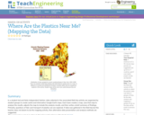
Geographic information systems (GIS), once used predominantly by experts in cartography and …
Geographic information systems (GIS), once used predominantly by experts in cartography and computer programming, have become pervasive in everyday business and consumer use. This unit explores GIS in general as a technology about which much more can be learned, and it also explores applications of that technology. Students experience GIS technology through the use of Google Earth on the environmental topic of plastics in the ocean in an area known as the Great Pacific Garbage Patch. The use of this topic in GIS makes the unit multidisciplinary, incorporating the physics of ocean currents, the chemistry associated with pollutant degradation and chemical sorption to organic-rich plastics, and ecological impact to aquatic biota.
Students pass around and distort messages written on index cards to learn …
Students pass around and distort messages written on index cards to learn how we use signals from GPS occultations to study the atmosphere. The cards represent information sent from GPS satellites being distorted as they pass through different locations in the Earth's atmosphere and reach other satellites. Analyzing GPS occultations enables better global weather forecasting, storm tracking and climate change monitoring.
This online lesson provides perspectives from Native American community members and their …
This online lesson provides perspectives from Native American community members and their supporters, images, news footage, an interactive timeline, and other sources about an important campaign to secure the treaty rights and sovereignty of Native Nations of the Pacific Northwest. Scroll to begin an exploration of the actions Native Nations took to address injustices.
This video segment adapted from NOVA features the youngest rock formations in …
This video segment adapted from NOVA features the youngest rock formations in the Grand Canyon, lava dams, and how they are subject to the eroding power of water.
With this activity, students use a globe to learn how a position …
With this activity, students use a globe to learn how a position on Earth can be described. They investigate how latitude can be found using the stars. Students learn what latitude and longitude are and how to use them to indicate a position on Earth. They investigate how in some locations on Earth, the direction of the midday sun can change over the year.
This lesson unit provides an insight into the navigational methods of the …
This lesson unit provides an insight into the navigational methods of the Bronze Age Mediterranean peoples. The students explore the link between history and astronomical knowledge. Besides an overview of ancient seafaring in the Mediterranean, the students use activities to explore early navigational skills using the stars and constellations and their apparent nightly movement across the sky. In the course of the activities, they become familiar with the stellar constellations and how they are distributed across the northern and southern sky.
Celestial navigation is the art and science of finding one's geographic position …
Celestial navigation is the art and science of finding one's geographic position by means of astronomical observations, particularly by measuring altitudes of celestial objects sun, moon, planets or stars. This activity starts with a basic, but very important and useful, celestial measurement: measuring the altitude of Polaris (the North Star) or measuring the latitude.
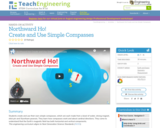
Students create and use their own simple compasses, which are each made …
Students create and use their own simple compasses, which are each made from a bowl of water, strong magnet, stick pin and Styrofoam peanuts. They learn how compasses work and about cardinal directions. They come to understand that the Earth's magnetic field has both horizontal and vertical components.
An adaptable writing frame for teacher to comments; self evaluation and an …
An adaptable writing frame for teacher to comments; self evaluation and an indicator of whether the work was independent, shared or teacher assisted etc.
In this unit, students learn the very basics of navigation, including the …
In this unit, students learn the very basics of navigation, including the different kinds of navigation and their purposes. The concepts of relative and absolute location, latitude, longitude and cardinal directions are explored, as well as the use and principles of maps and a compass. Students discover the history of navigation and learn the importance of math and how it ties into navigational techniques. Understanding how trilateration can determine one's location leads to a lesson on the global positioning system and how to use a GPS receiver. The unit concludes with an overview of orbits and spacecraft trajectories from Earth to other planets.
Students use their knowledge of scales and areas to determine the best …
Students use their knowledge of scales and areas to determine the best locations in Alabraska for the underground caverns. They cut out rectangular paper pieces to represent caverns to scale with the maps and place the cut-outs on the maps to determine feasible locations.
This animation adapted from NASA shows the orbital paths of spacecraft in …
This animation adapted from NASA shows the orbital paths of spacecraft in NASA's Earth Observing Fleet that are a source of wide-scale, primary research about Earth.
This interactive resource adapted from the National Park Service illustrates the variety …
This interactive resource adapted from the National Park Service illustrates the variety of landforms and features created by volcanoes. Featured are calderas, craters, fumaroles and other geothermal features, igneous rocks, lava flows, lava tubes, and maars.
Students learn of the impending asteroid impact scenario, form teams and begin …
Students learn of the impending asteroid impact scenario, form teams and begin to study the situation in depth. A simple in-class simulation shows them the potential for destruction and disaster. They complete worksheets and look at maps to help them define and understand the problem: What is the needed cavern size and depth? What are the geographical areas and natural features? A homework measurement assignment prepares them for the next lesson/activity.
In a student-led and fairly independent fashion, data collected in the associated …
In a student-led and fairly independent fashion, data collected in the associated field trip activity are organized by student groups to create useful and informative Google Earth maps. Each team creates a map, uses that map to analyze the results, adjusts the map to include the analysis results, and then writes a brief summary of findings. Primarily, questions of fate-and-transport of plastics are are explored. If data was gathered in the field trip but the teacher does not desire to do the mapping activity, then alternative data presentation and analysis methods are suggested.
No restrictions on your remixing, redistributing, or making derivative works. Give credit to the author, as required.
Your remixing, redistributing, or making derivatives works comes with some restrictions, including how it is shared.
Your redistributing comes with some restrictions. Do not remix or make derivative works.
Most restrictive license type. Prohibits most uses, sharing, and any changes.
Copyrighted materials, available under Fair Use and the TEACH Act for US-based educators, or other custom arrangements. Go to the resource provider to see their individual restrictions.